![]()
In collaboration with American Airlines and Breakthrough
Energy, Bill Gates’ climate investment fund, Google has developed contrailforecast maps that can create more sustainable flight routes.
Contrails are white condensation streaks that planes
sometimes leave behind in the sky, and they account for about 35% of aviation's
global warming impact. By avoiding certain routes that create contrails, pilots
can reduce environmental footprint.

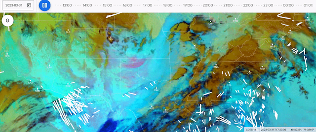
This is where Google’s innovation plays its role – the tech giant
has used satellite imagery and AI to design forecasts that can detect where
contrails are most likely to form. First, satellite imagery is used to spot and
label contrails. The data is then used to train an AI model to detect contrails
in the satellite imagery. More specifically, as a result, pilots are therefore
able to spot areas where humidity is higher and avoid them, as contrails are
less likely to persist where humidity is lower.
The contrail forecast maps have since been used by American
Airlines for a trial with 70 flights over a period of six months. Satellite imagery of the test
flights showed that flights where pilots avoided contrails resulted in cut down
of contrails by 54%, as compared to those where pilots did not try to avoid
contrails. This shows a significant difference and gives us some hope with
regard to improved sustainability practices for the future of the earth.
